Identify High-Risk Areas
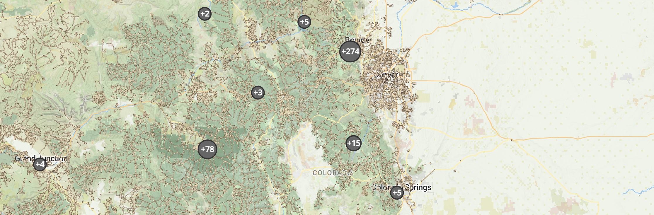
Map and monitor wildfire-prone zones. Target resources where they are most needed to reduce hazards.
Keep fire risks in check with clear, actionable steps.

Minimize Wildfire Impact Before It Starts
Outway centralizes risk assessments, mitigation tasks, and response coordination, helping land managers effectively reduce wildfire hazards.
Preserving communities at risk of wildfires in the western United States is no easy task. A changing environment presents more risks and prolongs the fire season each year, and teams struggle to obtain adequate resources to tackle and keep up with these problems.
Front-range fire teams are now using Outway to tackle issues as they arise and plan to keep communities safe. These teams are doing it all in Outway: prescribed burns, mapping assets, communicating across teams and regions, scheduling tasks, you name it! With Outway, their coordinated efforts improved wildfire readiness and reduced risks across the entire front range and beyond.
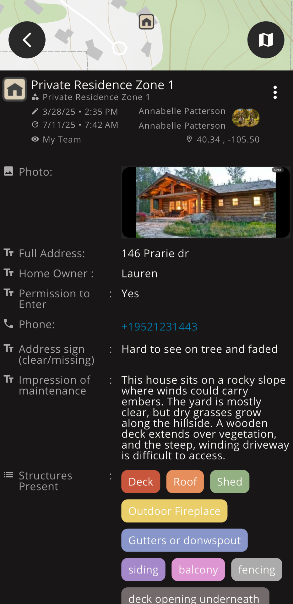
A: Teams can label high-risk zones in detail to assess and pinpoint the most vulnerable areas, allowing for targeted prevention strategies.
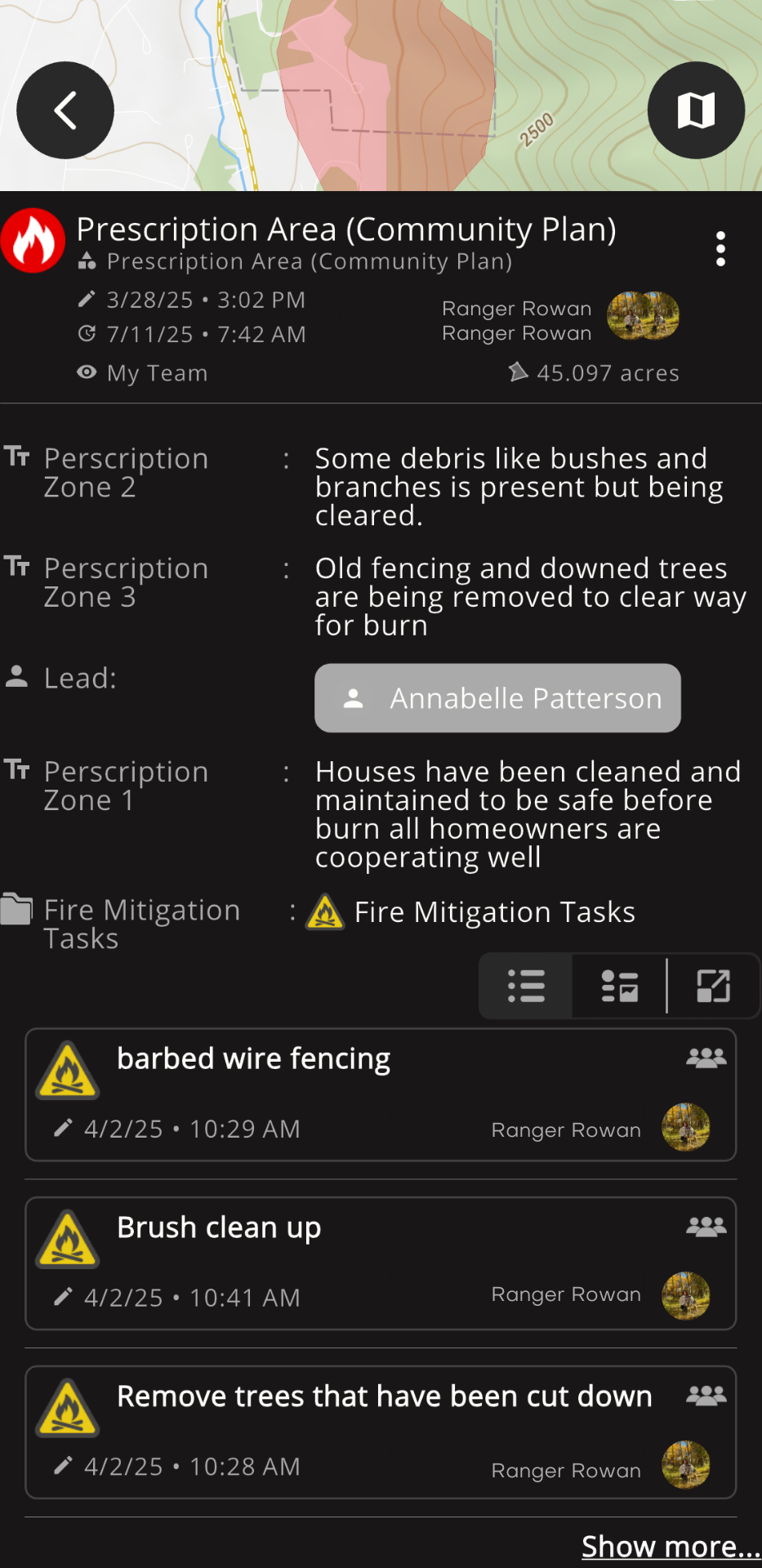
A: Absolutely! Assign and track tasks like creating firebreaks or conducting prescribed burns, ensuring everyone knows their role and progress is monitored.
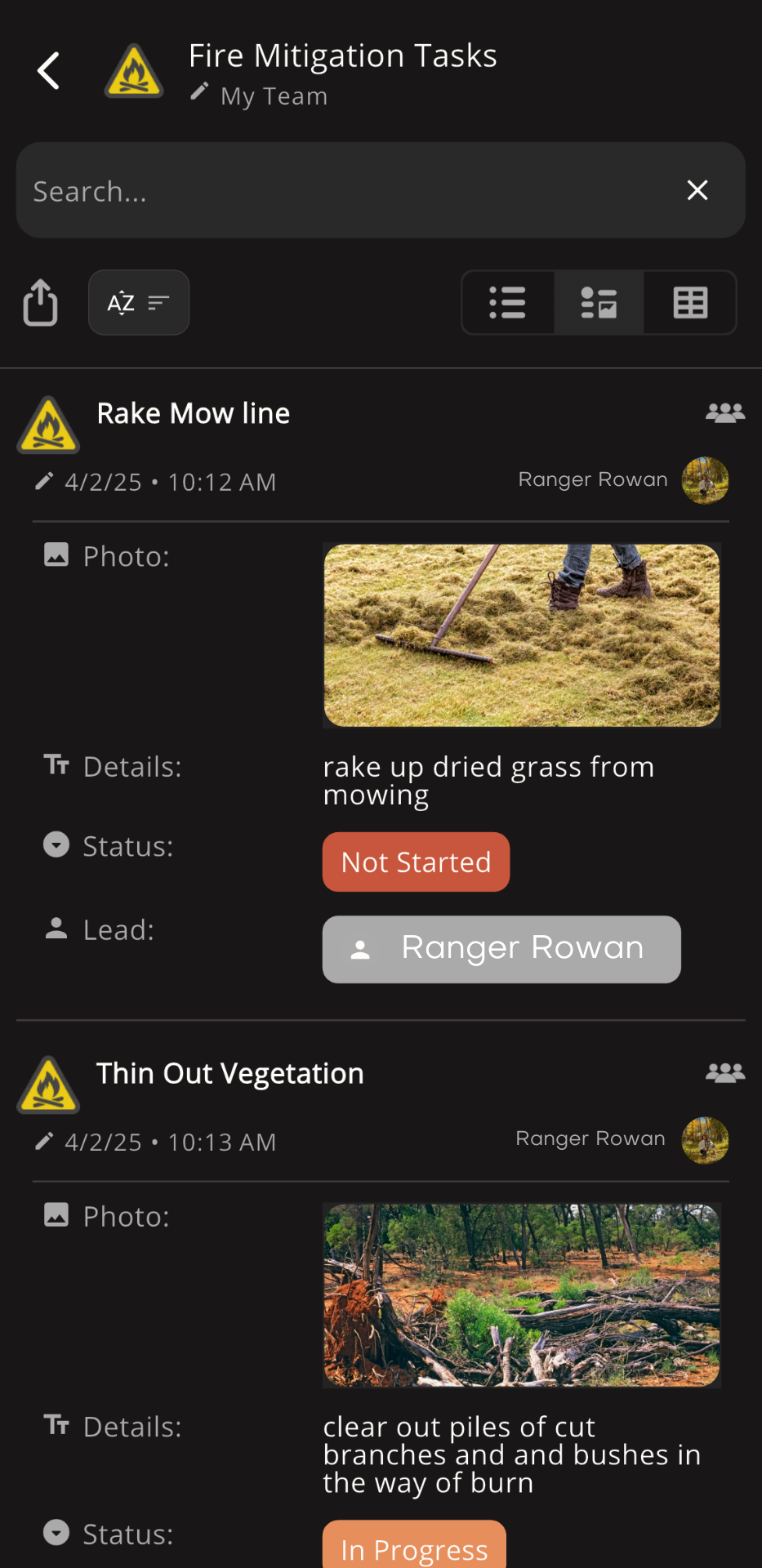
A: Real-time updates on mitigation efforts, such as prescribed burns and mowing break status, ensure all tasks are completed efficiently and risks are minimized.
A: Yes! You can share comprehensive fire mitigation reports with communities, agencies, and partners to align on goals and improve preparedness.
Investing in Wildfire Resilience: How Front Range Teams are Leading the Way