Urban Conservation, Reimagined: How Lafayette Transformed Stewardship with Outway
How a front range team in utilizing Outway for their land management efforts

Urban Conservation, Reimagined: How Lafayette Built a Stronger Program with Outway
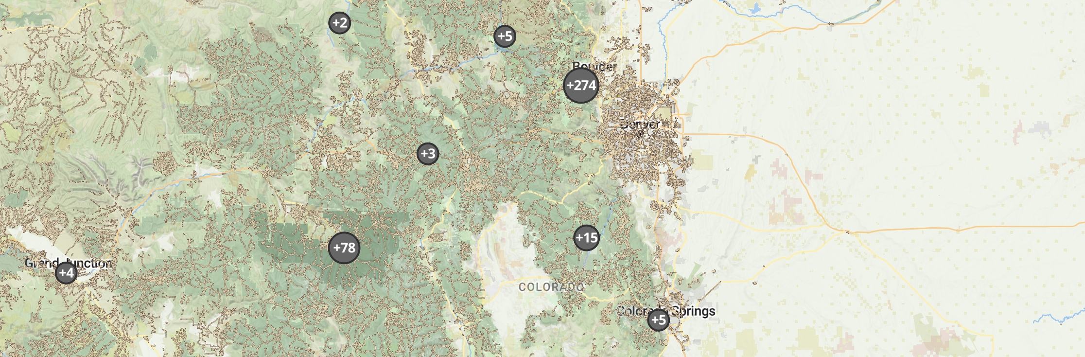
Located between Denver and Boulder, Lafayette is a fast-growing community working hard to protect its natural spaces. With about 40,000 residents, the city manages a mix of prairies, riparian corridors, farms, and parks, all without a traditional ranger program. Instead, they rely on signage, fencing, and a lot of community trust to protect sensitive areas.
As the city grew and pressures like fire risk mounted, Lafayette's small but mighty open space team needed a better way to track their work, advocate for resources, and protect what made their lands special. That's when they brought in Outway.

The Challenge: Managing Urban Conservation Without a Ranger Program
Managing conservation lands in an urban setting is tough, especially when you're a small team without rangers on patrol. Lafayette's open space staff manages a wide range of tasks, from habitat restoration to invasive species removal. All the while managing vandalism and visitor impacts, they always felt it was hard to keep up.
Things became even more challenging after the Marshall Fire in 2021. Fire mitigation became a top priority almost overnight, but without formal systems to document and track their work, it was hard to show the scale of what needed to be done or secure the resources to do it.
"They had all this pressure and no added resources," said Aaron, CEO of Outway. "It really speaks to their team's talent—and how Outway could help them move forward."
Before Outway: Markers and Paper Forms
Before Outway, Lafayette's tracking system was pretty basic. Fieldwork was marked up on laminated maps with Expo markers, and chemical applications were logged on paper and filed away. With most work happening outdoors, keeping consistent, accessible records was tough.
Outway changed that.

The Solution: A Modern Approach to Urban Land Management
What is Outway?
Outway is a fieldwork and data management platform built for land stewards. Designed to replace outdated spreadsheets and disconnected processes, it helps teams track their work, visualize data, and make informed decisions—all in one place, in real-time. Whether managing urban open spaces or remote conservation areas, Outway streamlines workflows and ensures that critical land management efforts are well-documented, efficient, and impactful.
Smarter Fieldwork, Better Reporting
Outway gave Lafayette an easy way to capture work happening in the field—and turn it into real, actionable data. Field crews can log tasks on the fly, managers can view updates instantly, and reporting to city leadership is faster and more credible than ever.
Tracking Wildlife in an Urban Landscape
In Lafayette, conservation doesn't happen far from people—it happens right next to neighborhoods, schools, and roads. Outway's geospatial tools made it easier to monitor human-wildlife interactions, track beaver reintroduction sites, and measure the success of riparian restoration projects.
Responding to Fire Risk
After the Marshall Fire, Lafayette needed to move quickly on fire mitigation. With Outway, they were able to document mowing, brush clearing, and other preventive efforts in ways that reassured residents and helped shape stronger city policies.
Advocacy Made Simple
The biggest shift? Visibility. Now, Lafayette's open space program can show the full scale of its work with clear, easy-to-understand reports. That data has already started turning heads—and opening doors—for more funding and staffing.
"People need to see why things like brush clearing matter," Aaron said. "Outway helped make that visible, helping them advocate for the resources they deserve."

Results: A Stronger, More Resilient Program
Since adopting Outway, Lafayette's open space team has become one of the platform's most active users. One team member now logs hundreds of work locations a year—a huge leap from the Expo marker days.
They've also been able to track the impacts of human activity more closely, adjust restoration strategies, and engage volunteers and residents in new ways. Now, when volunteers plant trees or pull weeds, they can see how their work contributes to larger conservation goals.
City officials have noticed, too. Lafayette's open space program is increasingly recognized as vital to the city's future.
What's Next for Lafayette?
Lafayette's story shows how the right tools can transform urban land management. By switching from ad-hoc tracking to a data-driven approach, they've strengthened their program, made it more visible, and better prepared for the future.
"This team has been amazing to work with," said Nico, a member of the Outway team. "They're not just using the platform—they're helping us build it better for urban conservation."
As Lafayette continues to grow, its work sets a model for other cities that balance development with stewardship, proving that urban conservation can thrive with the right approach.
Images from:
https://www.lafayetteco.gov/facilities/facility/details/greenleewildlifepreserve-79
Photo by Emily Levine on Unsplash